mongabay.com
April 20, 2011
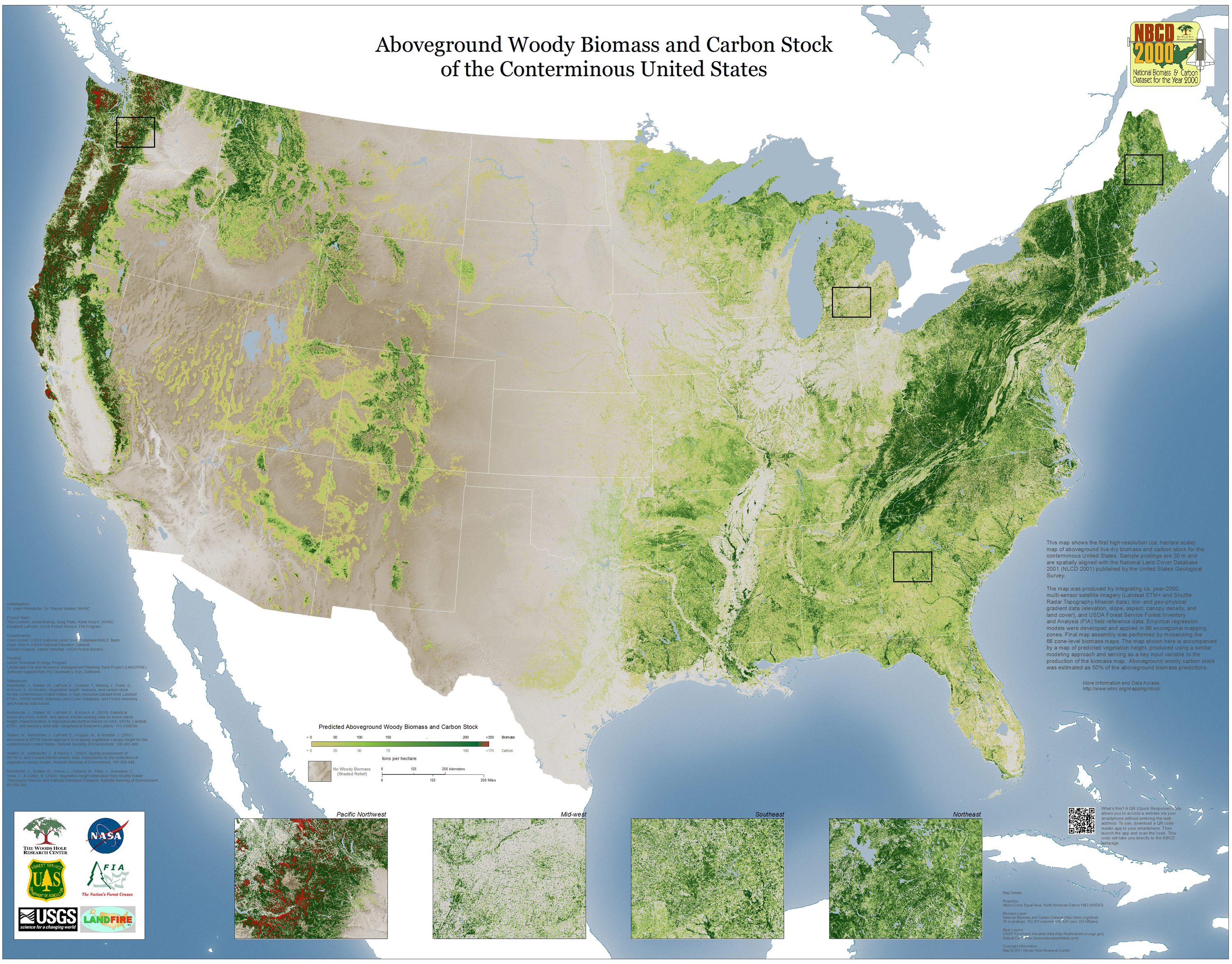
The National Biomass and Carbon Dataset (NBCD) map of the continental US courtesy of Woods Hole Research Center. Click to enlarge.
The Woods Hole Research Center (WHRC) has released the first hectare-scale map displaying aboveground woody biomass and forest carbon in US forests. The map, which also shows canopy heights, is known as the National Biomass and Carbon Dataset (NBCD).
"The dataset represents a comprehensive assessment of forest structure and carbon stock within the lower 48 States at the beginning of the third millennium, providing an important baseline with which to improve our understanding of the United States forest resources and its link to the terrestrial carbon flux in North America," said Dr. Josef Kellndorfer, who led the project, adding that "this dataset will be useful to foresters, wildlife ecologists, resource managers, and scientists alike."
The map shows forest conditions for the year 2000 and, as such, will provide a baseline for future changes to US forest cover.
"Naturally we are keen to produce the next generation data sets of this kind to assess in detail how carbon stock and forest structures are changing in this country, and internationally," said Kellndorfer.
The map was funded under NASA's Terrestrial Ecology Program with support from the Landscape Fire and Resource Management Planning Tools Project (LANDFIRE).
The map can be accessed at: Woods Hole Research Center's National Biomass Carbon Dataset.
Jeremy Hance
"The dataset represents a comprehensive assessment of forest structure and carbon stock within the lower 48 States at the beginning of the third millennium, providing an important baseline with which to improve our understanding of the United States forest resources and its link to the terrestrial carbon flux in North America," said Dr. Josef Kellndorfer, who led the project, adding that "this dataset will be useful to foresters, wildlife ecologists, resource managers, and scientists alike."
The map shows forest conditions for the year 2000 and, as such, will provide a baseline for future changes to US forest cover.
"Naturally we are keen to produce the next generation data sets of this kind to assess in detail how carbon stock and forest structures are changing in this country, and internationally," said Kellndorfer.
The map was funded under NASA's Terrestrial Ecology Program with support from the Landscape Fire and Resource Management Planning Tools Project (LANDFIRE).
The map can be accessed at: Woods Hole Research Center's National Biomass Carbon Dataset.
No comments:
Post a Comment